
Introduction
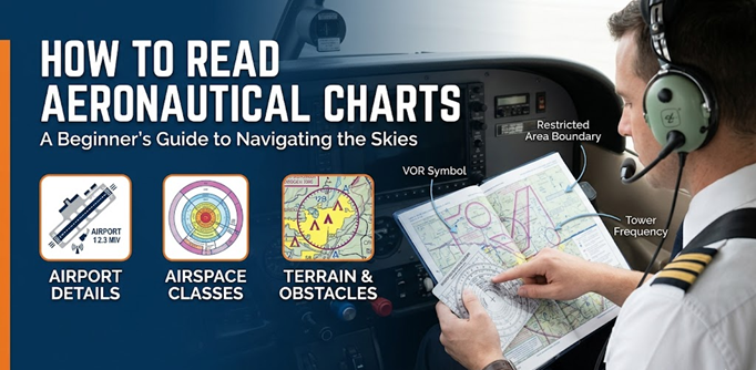
Learning how to read aeronautical charts is one of the most important skills for any beginner pilot. Before a pilot takes off, they must understand where they are going, what airspace they will enter, which airports are nearby, what obstacles may be present, and which radio frequencies may be needed.
An aeronautical chart is like a road map for pilots, but it contains much more aviation information than a normal map. It shows airports, runways, controlled airspace, navigation aids, terrain height, obstacles, restricted areas, communication frequencies, and many other details that help pilots fly safely.
For a student pilot, aeronautical charts may look confusing at first. There are many colors, symbols, numbers, lines, circles, and abbreviations. However, once you understand the basic structure, chart reading becomes easier and more interesting.
This guide explains aeronautical chart reading in simple English so that beginner pilots, aviation students, and flight training learners can understand the basics clearly.
What Are Aeronautical Charts?
Aeronautical charts are special maps designed for aviation use. Pilots use them to plan flights, navigate in the air, avoid unsafe areas, and understand the airspace around them.
A normal road map helps drivers follow roads. An aeronautical chart helps pilots follow safe routes through the sky. It gives information about airports, airways, navigation points, communication frequencies, terrain, and airspace rules.
These charts are used by student pilots, private pilots, commercial pilots, flight instructors, dispatchers, and aviation planners. Even with modern GPS systems, pilots still need to understand charts because charts show the full aviation picture around the aircraft.
Why Learning to Read Aeronautical Charts Matters
Aeronautical chart reading is not just a classroom topic. It is a real flying skill. A pilot who understands charts can make better decisions before and during flight.
Chart reading helps pilots in many ways.
Safe Navigation
Pilots use charts to know their route, direction, distance, and nearby landmarks. This helps them avoid getting lost during visual flight.
Better Flight Planning
Before flying, pilots check the chart to choose a safe route, plan altitude, identify airports, and review airspace.
Understanding Airspace
Different airspace areas have different rules. Some require communication with air traffic control. Some may require clearance before entry. Charts help pilots identify these areas.
Avoiding Restricted Areas
Some areas are restricted, prohibited, dangerous, or used for military activity. Pilots must avoid or follow special rules before entering them.
Finding Airports and Landmarks
Charts show airports, cities, rivers, roads, lakes, towers, and other visual landmarks. These are useful for navigation.
Using Communication Frequencies
Charts provide important radio frequencies for airports, towers, approach control, flight service, and navigation aids.
Building Pilot Confidence
A beginner pilot who can read charts feels more confident during training. It also helps them understand what is happening outside the cockpit.
Types of Aeronautical Charts
There are different types of aeronautical charts. Each chart has a different purpose. Beginner pilots should first understand the common ones.
Sectional Charts
Sectional charts are commonly used by pilots flying under visual flight rules. They show airports, airspace, terrain, landmarks, navigation aids, obstacles, and communication information.
These charts are very useful for student pilots because they help them understand the local flying area.
A sectional chart is often the first chart a pilot learns to read during flight training.
Terminal Area Charts
Terminal Area Charts show busy airport areas in greater detail. They are used around large cities and major airports where airspace is more complex.
These charts help pilots understand detailed airspace boundaries, controlled zones, airports, and routes near busy terminal areas.
A student pilot flying near a large airport may need to study a Terminal Area Chart carefully.
World Aeronautical Charts
World Aeronautical Charts cover larger areas and show less detail compared to sectional charts. They are useful for longer flights where a pilot needs to see a wide area.
These charts are not usually the first choice for very detailed local flying, but they help in broad route planning.
Enroute Charts
Enroute charts are mainly used for flights under instrument flight rules. They show airways, navigation fixes, radio navigation aids, minimum altitudes, and controlled routes.
Instrument-rated pilots use enroute charts for planned navigation when flying in controlled airspace or poor visibility conditions.
Airport Diagrams
Airport diagrams show the layout of an airport. They include runways, taxiways, ramps, parking areas, buildings, and sometimes hot spots where extra caution is needed.
These charts are useful before taxiing at unfamiliar airports.
Approach Charts
Approach charts are used by instrument pilots during landing procedures. They show the route, altitude, descent path, navigation aids, missed approach instructions, and runway information.
Beginner pilots may not use approach charts in early training, but they become important during instrument training.
Main Elements of an Aeronautical Chart
Aeronautical charts contain many details. A beginner should not try to learn everything in one day. Start with the main elements first.
Airports
Airports are shown with specific symbols. The symbol may tell whether the airport has a control tower, paved runway, lighting, or other facilities.
Airport information usually includes the airport name, elevation, runway length, and communication frequency.
Runways
Runway information helps pilots understand landing and takeoff options. Charts may show runway length, surface type, and lighting details.
Runway numbers are based on magnetic direction. For example, Runway 27 usually points roughly west.
Airspace Boundaries
Airspace boundaries are shown using different colored lines, circles, boxes, and shapes. Each type of airspace has different rules.
Understanding airspace is one of the most important parts of chart reading.
Navigation Aids
Navigation aids help pilots find direction and position. Common examples include VOR, NDB, GPS waypoints, and airways.
Charts show navigation aids with symbols, names, frequencies, and identification codes.
Radio Frequencies
Charts show communication frequencies for airports, towers, approach control, departure control, flight service, and navigation aids.
A pilot must know which frequency to use before entering controlled airspace or approaching an airport.
Obstacles
Obstacles include towers, antennas, wind turbines, buildings, or other tall structures. Charts show obstacle height so pilots can maintain safe clearance.
Obstacle awareness is very important during low-altitude flying.
Terrain Elevation
Charts use colors and numbers to show terrain elevation. High terrain is usually shown with darker colors or elevation markings.
Pilots use this information to avoid mountains, hills, and rising ground.
Special Use Airspace
Special use airspace includes restricted areas, prohibited areas, warning areas, military operation areas, and alert areas.
Pilots must understand these areas before flight because some may be unsafe or illegal to enter without permission.
Understanding Chart Symbols
Aeronautical charts use symbols to save space and show information quickly. At first, these symbols may look difficult, but they become easier with practice.
Airport Symbols
Airport symbols show different types of airports.
A towered airport usually has a different symbol from a non-towered airport. Some airports are public, while others may be private or restricted.
A beginner pilot should learn how to identify:
- Public airports
- Private airports
- Towered airports
- Non-towered airports
- Seaplane bases
- Heliports
- Military airports
Towered and Non-Towered Airports
A towered airport has an operating control tower. Pilots must communicate with air traffic control before landing, taking off, or moving in controlled areas.
A non-towered airport does not have an active control tower. Pilots communicate on a common traffic frequency and follow standard traffic pattern procedures.
VOR Symbols
A VOR is a radio navigation aid. It helps pilots navigate by using radio signals. On charts, a VOR is shown with a special symbol, name, frequency, and Morse code identification.
Student pilots often learn VOR navigation during training because it builds strong navigation understanding.
NDB Symbols
An NDB is another type of radio navigation aid. It is older than GPS and VOR systems but may still appear on charts in some areas.
Pilots should know what the symbol means, even if they do not use it often.
Obstacle Symbols
Obstacle symbols show tall structures that may be dangerous to aircraft. These may include towers, antennas, cranes, or wind turbines.
The chart usually shows the obstacle height above mean sea level and sometimes above ground level.
Special Use Airspace Symbols
Special use airspace is marked with boundaries and labels. These areas may have military training, weapons activity, restricted flying, or other hazards.
Pilots must check whether the area is active before flying near or through it.
Understanding Airspace on Aeronautical Charts
Airspace is one of the most important parts of aeronautical chart reading. The sky is divided into different classes. Each class has different rules for communication, weather minimums, pilot qualification, and aircraft equipment.
Class A Airspace
Class A airspace is high-altitude controlled airspace. It is mainly used by aircraft flying under instrument flight rules.
Student pilots usually do not fly in Class A during early training.
Class B Airspace
Class B airspace is found around very busy major airports. It usually has a layered shape, often compared to an upside-down wedding cake.
Pilots need clearance from air traffic control before entering Class B airspace.
Class C Airspace
Class C airspace surrounds busy airports with control towers and radar approach control.
Pilots must establish two-way radio communication before entering Class C airspace.
Class D Airspace
Class D airspace is usually found around airports with operating control towers.
Pilots must communicate with the tower before entering.
Class E Airspace
Class E airspace is controlled airspace that is not Class A, B, C, or D. It may begin at different altitudes depending on the location.
Charts show Class E boundaries in different ways, so pilots must study them carefully.
Class G Airspace
Class G airspace is uncontrolled airspace. Air traffic control does not provide the same level of control in this area.
However, pilots still must follow aviation rules and maintain safety.
How to Read Airport Information on Charts
Airport information is one of the most useful parts of an aeronautical chart. When you look at an airport on a chart, you may see several details near the symbol.
Important airport details include:
- Airport name
- Airport identifier
- Airport elevation
- Runway length
- Lighting availability
- Control tower frequency
- Common traffic frequency
- Fuel availability
- Services
- Special notes
For example, if a chart shows an airport elevation of 850 feet, it means the airport is 850 feet above mean sea level. This is important for altimeter setting, performance calculation, and landing planning.
Runway length is also important. A small training aircraft may use a shorter runway, but performance still depends on aircraft weight, temperature, wind, and runway surface.
How to Read Navigation Aids
Navigation aids help pilots know where they are and where they are going. Even in the GPS age, pilots should understand traditional navigation aids because they are still part of aviation training and backup planning.
VOR
A VOR sends radio signals that help pilots navigate along specific directions called radials. Charts show the VOR name, frequency, and identification code.
Pilots can use VORs to track a route or confirm position.
NDB
An NDB sends a radio signal in all directions. Aircraft equipment can point toward the station.
NDB navigation is older but still useful to understand.
GPS Waypoints
GPS waypoints are fixed points used in modern navigation. They may appear as named points on charts and flight planning systems.
Pilots use waypoints to build routes and follow planned tracks.
Victor Airways
Victor airways are low-altitude routes based on navigation aids. They are like highways in the sky for aircraft flying under instrument flight rules.
They are shown on enroute charts and help pilots follow structured routes.
Compass Rose
A compass rose around a navigation aid helps pilots understand direction. It shows degrees around the station.
This helps pilots identify radials and bearings.
Understanding Terrain and Obstacles
Terrain and obstacles are critical for safety. A pilot must always know the height of the ground and structures along the route.
Charts show terrain using colors, contour lines, and elevation numbers. Higher terrain may be shown with darker shading. Maximum elevation figures may also appear in chart quadrangles to help pilots understand the highest feature in that area.
Obstacles are marked because they may be difficult to see from the air, especially in low visibility, haze, night conditions, or during high workload.
Before flight, a pilot should check:
- Highest terrain along the route
- Tall towers or antennas
- Mountain areas
- Wind turbines
- Minimum safe altitude
- Emergency landing options
A safe pilot always leaves enough altitude margin above terrain and obstacles.
How Pilots Use Aeronautical Charts for Flight Planning
Aeronautical charts are very useful during flight planning. A pilot does not simply draw a line from one airport to another. They must check airspace, terrain, weather, obstacles, communication, and backup options.
Here is a simple step-by-step process.
Step 1: Choose Departure and Destination Airports
First, identify the airport where the flight will start and the airport where it will end.
Check the airport name, elevation, runway length, and available services.
Step 2: Draw or Plan the Route
Draw a route between the two airports or create a route in a flight planning tool.
Avoid restricted areas, high terrain, and complex airspace unless properly trained and authorized.
Step 3: Check Airspace Along the Route
Look at all airspace boundaries along the route.
Ask these questions:
- Will the flight enter controlled airspace?
- Is ATC communication required?
- Is clearance required?
- Are there special rules in that area?
Step 4: Identify Visual Landmarks
Choose landmarks that are easy to see from the air.
Good landmarks include:
- Rivers
- Lakes
- Highways
- Railway lines
- Cities
- Large buildings
- Coastlines
These landmarks help pilots confirm their position during visual navigation.
Step 5: Check Terrain and Obstacles
Look for mountains, hills, towers, and other obstacles.
Plan an altitude that provides safe clearance.
Step 6: Find Navigation Aids
Check for nearby VORs, NDBs, GPS waypoints, or airways that can help with navigation.
Even if flying visually, navigation aids can provide backup support.
Step 7: Note Communication Frequencies
Write down all important frequencies before flight.
These may include:
- Departure airport frequency
- Tower frequency
- Ground frequency
- Approach frequency
- Destination airport frequency
- Emergency frequency
- Flight service frequency
Step 8: Plan Safe Altitudes
Choose an altitude that keeps the aircraft clear of obstacles, terrain, and airspace conflicts.
Also consider weather, cloud clearance, aircraft performance, and direction of flight.
Step 9: Mark Checkpoints
Select checkpoints along the route. These help pilots confirm progress and timing.
Each checkpoint should be easy to identify from the air.
Step 10: Prepare Backup Options
Always identify alternate airports or safe landing areas.
A good pilot thinks ahead and prepares for unexpected weather, mechanical issues, or navigation problems.
Beginner Example: Reading a Chart for a Short Flight
Imagine a student pilot planning a short flight from Airport A to Airport B.
The pilot first finds both airports on the sectional chart. They check the runway length, airport elevation, and communication frequencies.
Next, the pilot draws a route between the two airports. Along the route, they notice a small Class D airspace near another airport. Since Class D airspace requires communication with the tower, the pilot decides either to contact the tower or adjust the route to stay outside that airspace.
The pilot then checks terrain. The chart shows a few towers near the route, so the pilot plans an altitude that gives safe clearance.
After that, the pilot selects three checkpoints: a river bend, a highway crossing, and a small town. These will help confirm the aircraft’s position during flight.
Finally, the pilot writes down the required frequencies and identifies one alternate airport in case weather changes or the flight needs to land early.
This simple example shows how aeronautical chart reading turns a flight idea into a safe flight plan.
Common Mistakes Beginners Make While Reading Charts
Beginner pilots often make small mistakes while learning chart reading. These mistakes are normal during training, but they must be corrected early.
Ignoring Airspace Boundaries
Some students focus only on the route and forget to check airspace. This can lead to accidental entry into controlled or restricted airspace.
Always check airspace before flight.
Misreading Airport Symbols
A beginner may confuse towered and non-towered airports. This can create communication mistakes.
Learn airport symbols carefully.
Forgetting Airport Elevation
Airport elevation affects performance, altimeter awareness, and landing planning.
Never ignore elevation information.
Missing Restricted Areas
Restricted areas may not always be active, but pilots must check before flying near them.
Do not assume an area is safe without checking.
Not Checking Frequencies
Pilots should write down frequencies before flight. Searching for frequencies in the air increases workload.
Prepare them in advance.
Confusing Magnetic and True Direction
Aviation uses both true and magnetic references. Beginner pilots must understand the difference during navigation planning.
Ask your instructor to explain this clearly during flight training.
Using Old Charts
Aeronautical information changes. Airspace, frequencies, airport data, and procedures can be updated.
Pilots should always use current charts.
Relying Only on GPS
GPS is helpful, but pilots should not depend only on it. A good pilot understands charts, landmarks, navigation aids, and backup planning.
Chart knowledge is a core pilot skill.
Tips to Learn Aeronautical Chart Reading Faster
Chart reading improves with practice. Do not try to memorize everything in one sitting. Learn step by step.
Start With Your Local Area
Begin by studying the area around your flight school. Find nearby airports, airspace, roads, rivers, and landmarks.
Learn Symbols Slowly
Pick a few symbols each day. Learn airport symbols first, then airspace, obstacles, and navigation aids.
Use Real Airports for Practice
Choose real airports and read their chart information. This makes learning practical.
Compare Charts With Normal Maps
Compare the aeronautical chart with a regular map or satellite view. This helps you connect chart symbols with real-world locations.
Practice Route Planning
Plan short practice routes on paper. Check airspace, terrain, obstacles, and frequencies.
Ask Your Flight Instructor
Your instructor can explain chart details using real flight examples. This is one of the best ways to learn.
Review Charts Before Every Lesson
Before each flying lesson, look at the chart for the training area. This builds familiarity.
Keep Charts Updated
Always use current charts. Old chart information can be unsafe.
Aeronautical Chart Reading Checklist
Use this simple checklist before planning a flight.
Airport Information
- Departure airport checked
- Destination airport checked
- Alternate airport selected
- Runway length reviewed
- Airport elevation checked
- Frequencies noted
Airspace
- Controlled airspace identified
- Restricted areas checked
- Prohibited areas avoided
- Military operation areas reviewed
- Required communication understood
Navigation
- Route planned
- Checkpoints selected
- Landmarks identified
- Navigation aids checked
- GPS waypoints reviewed
Terrain and Obstacles
- Highest terrain checked
- Towers and obstacles reviewed
- Safe altitude planned
- Emergency landing areas considered
Flight Safety
- Current chart used
- Weather checked
- Frequencies written down
- Backup route planned
- Instructor or briefing source consulted when needed
How to Read Aeronautical Charts With Confidence
Confidence comes from repeated practice. At first, charts may look crowded. But after a few lessons, you will start recognizing common symbols and patterns.
The best way to learn is to connect chart information with real flying experience. When you see a river on the chart and then see it from the aircraft, the chart becomes meaningful. When you identify an airport symbol and then hear its tower frequency on the radio, the information becomes practical.
Good chart reading is not about memorizing every symbol at once. It is about understanding what information matters for the flight you are planning.
A safe pilot always asks:
- Where am I going?
- What airspace will I enter?
- What altitude is safe?
- What frequencies do I need?
- What obstacles are nearby?
- Where can I land if plans change?
These questions help turn chart reading into safe decision-making.
FAQs About How to Read Aeronautical Charts
1. What is an aeronautical chart?
An aeronautical chart is a special aviation map used by pilots. It shows airports, airspace, terrain, obstacles, navigation aids, and communication information.
2. Are aeronautical charts difficult to read?
They may look difficult at first, but they become easier with practice. Beginner pilots should start with basic symbols, airports, and airspace.
3. Why do pilots still need charts when GPS exists?
GPS is useful, but charts give a wider understanding of airspace, terrain, airports, obstacles, and backup navigation. Pilots should not rely only on GPS.
4. What is a sectional chart?
A sectional chart is a common aviation chart used for visual flight. It shows detailed information about airports, airspace, terrain, landmarks, and navigation aids.
5. How do I identify airports on a chart?
Airports are shown with specific symbols. The symbol may show whether the airport is towered, non-towered, public, private, or military.
6. What are airspace markings?
Airspace markings are lines, circles, and boundaries that show different classes of airspace. They help pilots understand communication and clearance requirements.
7. How often should pilots update charts?
Pilots should always use current charts because aviation information can change. Chart validity depends on the aviation authority and chart type.
8. Can beginner pilots learn chart reading at home?
Yes, beginners can practice at home by studying chart legends, airport symbols, airspace markings, and sample routes. However, instructor guidance is very helpful.
9. What is the most important thing to check on a chart?
Airspace, terrain, obstacles, airports, and communication frequencies are all important. For safety, pilots should never focus on only one item.
10. Do all pilots need to understand aeronautical charts?
Yes. Whether flying visually or using instruments, pilots need chart knowledge for safe navigation, planning, and decision-making.
Conclusion
Learning how to read aeronautical charts is a key step in becoming a safe and confident pilot. Charts help pilots understand airports, airspace, navigation aids, terrain, obstacles, communication frequencies, and safe routes.
For beginner pilots, the best approach is to learn slowly and practice often. Start with your local training area. Learn airport symbols, then airspace, then navigation aids and obstacles. Plan short routes and discuss them with your flight instructor.
Modern aviation has advanced GPS and digital tools, but chart reading remains a core pilot skill. A pilot who understands aeronautical charts is better prepared, more aware, and safer in the cockpit.
Aeronautical charts may look complex at first, but with regular practice, they become one of the most useful tools in pilot training.
